Anna Maria Island Waterfront Closings: Insurance & Seawall Checks
September 3, 2026
September 3, 2026
Every buyer who tours a waterfront home on Anna Maria Island arrives with the same spreadsheet: sale price, estimated mortgage payment, maybe a rough guess at property tax. What almost nobody brings to that first showing is the one number that actually determines whether the deal closes on schedule: whether the parcel sits inside or outside a federal boundary line drawn more than forty years ago, one that has nothing to do with zoning, elevation, or the county assessor.
That line is the Coastal Barrier Resources System boundary, and it is the reason two nearly identical canal homes a few blocks apart can have completely different insurance timelines, completely different lender requirements, and completely different odds of closing on the date written into the contract.
In 1982, Congress passed the Coastal Barrier Resources Act to discourage development on undeveloped, storm-prone barrier islands by cutting off federal money, including federal flood insurance, to land inside a mapped set of units known as the John H. Chafee Coastal Barrier Resources System. The law does not ban building on that land. It simply tells the federal government not to subsidize it, which means a property inside a CBRS unit cannot be covered by the National Flood Insurance Program at all, regardless of how the buyer intends to finance the purchase.
Portions of Anna Maria Island fall inside those mapped units. A buyer who assumes every Manatee County waterfront listing qualifies for standard NFIP coverage can lose real time discovering, mid-contract, that the federal program simply is not an option for that specific address. The fix is not complicated, but it has to happen before an offer goes in, not after: the U.S. Fish and Wildlife Service maintains a CBRS Mapper with a validation tool that will tell you, address by address, whether a parcel sits inside or outside the system. Running that check before writing an offer takes minutes. Finding out during the inspection period costs weeks.
The sale price tells you what the seller wants. The CBRS boundary tells you what your insurance options actually are.
Here is where the timing gets interesting for anyone closing on Anna Maria Island between now and early October. The National Flood Insurance Program itself operates on a periodic congressional reauthorization, and the current extension runs through September 30, 2026, exactly thirty days from today. Congress has allowed that authorization to lapse before, and a lapse typically means FEMA cannot issue new flood policies until lawmakers act again, which can complicate closings tied to federally backed mortgages while the gap lasts.
For a parcel inside the CBRS boundary, this deadline barely registers, since NFIP was never available there in the first place and the buyer is already shopping private flood carriers. For a parcel just outside that boundary, on the bay side or in a newer platted section of the island, the NFIP deadline is suddenly the thing to watch, because a lapse would remove the standard federal option those buyers were counting on and push them into the same private market their CBRS neighbors have always had to use. Knowing which side of the line your specific address falls on is not a formality. It tells you which insurance conversation you are actually having this fall.
FEMA's current pricing model, called Risk Rating 2.0, prices flood premiums to the individual parcel rather than to a community-wide average, using elevation, construction, and proximity to water rather than a flat flood-zone rate. Two homes in the same subdivision can carry very different premiums depending on how their lowest floor sits relative to Base Flood Elevation.
On Anna Maria Island, most properties fall in Zone AE, which carries a 1 percent annual flood chance and an established base elevation. Some Gulf-front and bay-side parcels carry the higher-risk VE designation. In practice, that generally means AE-zone waterfront premiums land somewhere in the four to eight thousand dollar range annually, while VE-zone parcels routinely run higher, often north of ten thousand. An outdated or missing elevation certificate is the single fastest way to blow past either estimate, because without current elevation data the carrier prices the property at whatever the worst-case assumption allows.
There is a second layer buyers should factor in for 2026 specifically. Citizens Property Insurance Corporation, Florida's insurer of last resort, has been phasing in a mandatory flood insurance requirement: policies with $400,000 or more in dwelling coverage were required to carry flood insurance starting January 1, 2026, and that requirement extends to all Citizens policies by January 1, 2027. Anyone whose current or prospective coverage runs through Citizens should confirm where their dwelling limit falls relative to that threshold before assuming their existing arrangement carries over.
Hurricanes Helene and Milton moved through the Gulf Coast in the fall of 2024, and the storm surge from Helene reached parts of Bradenton Beach at a scale the area had not experienced in roughly a century. The practical effect on today's market is that buyers are pulling permit histories before waiving inspection contingencies, not after. A home that underwent post-storm repair work without a permit is a red flag lenders are trained to catch during underwriting, and it can stall a closing at the worst possible moment, days before the scheduled date.
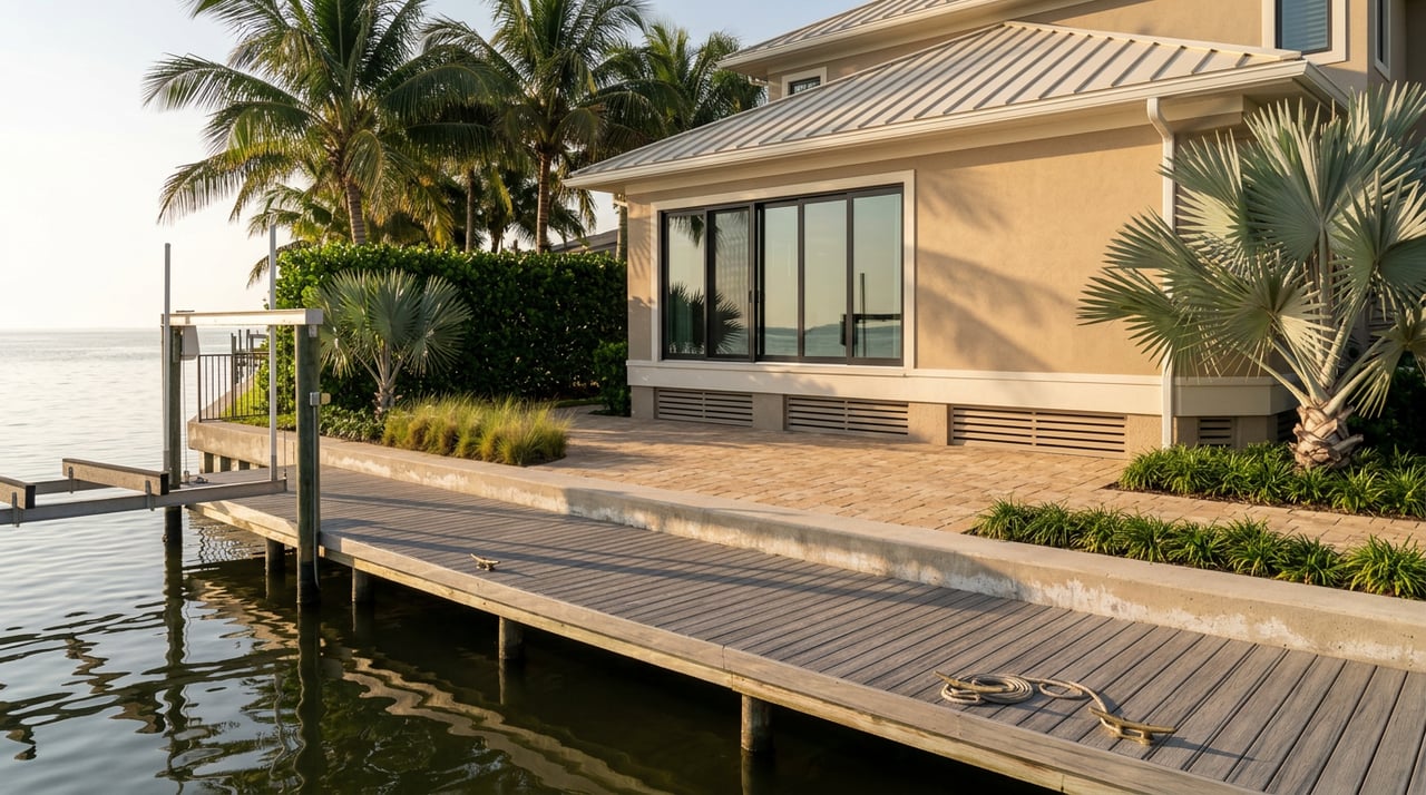
That same post-storm scrutiny extends to the marine structures buyers actually want: docks, boat lifts, and seawalls. In Florida, structures like these often extend over state-owned submerged lands, which can require a separate authorization from the state beyond the standard county building permit. Locally, Manatee County's Building and Development Services department handles the floodplain and building permit review, and its Floodplain Management section specifically reviews permit applications for compliance with the county's floodplain regulations. A dock or seawall with no permit history, or an expired submerged lands authorization, is not necessarily a dealbreaker, but it is exactly the kind of detail that needs a defined resolution path before closing, not a discovery during the final walkthrough.
None of these steps require a specialist. They require doing them in the right order, before the deposit is at risk rather than after.
Does being inside the CBRS boundary mean I can't insure the property at all? No. It means the National Flood Insurance Program isn't an option, so you'll be shopping private flood carriers instead. Private coverage is available, but it typically costs more and carries different terms than a standard NFIP policy, which is why getting a written quote early matters more here than in most other parts of coastal Florida.
If I'm paying cash, do any of these rules still apply to me? Flood insurance stops being legally required the moment there's no mortgage requiring it, but the underlying risk doesn't change based on how you finance the purchase. Cash buyers who skip the elevation certificate and permit check are simply choosing to carry that risk themselves rather than discovering it through a lender's underwriting process.
Is the September 30 deadline something I should actually worry about? It depends entirely on which side of the CBRS line your address falls on. If NFIP was never available to your specific parcel, the deadline changes little for you. If your parcel currently relies on NFIP, it's worth a direct conversation with your lender about contingency timing before you're locked into a closing date you can't move.
Anna Maria Island's waterfront market rewards buyers who do this homework before they fall in love with a specific address, not after. The list price has never been the number that determines whether a deal closes on schedule. The boundary line is.
If you're weighing an offer on Anna Maria Island, or trying to understand what your own property's insurance and permitting picture looks like before you decide whether to list it, Madison Wells can walk through what your specific address means for closing before you're under contract. Request your free home valuation and we'll start with the details that actually determine your timeline.
Stay up to date on the latest real estate trends.